Newsletters

November 2025 - monthly summary
November 2025 was the 3rd wettest in mainland Portugal since 2000 and the 3rd warmest globally. It was classified as normal in terms of mean air temperature and very wet in terms of precipitation.
Regarding air temperature, it was the 10th warmest November since 2000, with a mean air temperature of 12.47°C, +0.14°C above the 1991–2020 average. The mean maximum temperature (16.93°C) was 0.17°C above average, and the mean minimum temperature (8.01°C) was 0.11°C above normal. Air temperatures (maximum, mean and minimum) were predominantly above the monthly average up to 17 November, followed by a cold period until the end of the month.
In terms of precipitation, it was the 3rd wettest November of this century, with a total of 202.9 mm, corresponding to 180% of the 1991–2020 average. 15 new records for the highest November precipitation were recorded, five of which were absolute extremes.
Meteorological drought conditions eased across the entire territory, ending in the North and Centre regions. By 30 November, 21% of the territory was under weak meteorological drought.
The effects of Storm Claudia were strongly felt, with episodes of heavy and prolonged rainfall, hail and frequent thunderstorms, as well as strong winds and extreme wind phenomena.

October 2025 - monthly summary
October 2025 was the 2nd warmest in mainland Portugal since records began (1931) and the 3rd warmest on Earth, classified as very warm regarding air temperature and dry regarding precipitation.
For air temperature it was 2nd warmest October since 1931: mean temperature 19.00°C (+2.21°C); 4th highest mean maximum temperature: 24.57°C (+2.61°C) and the 6th highest mean minimum temperature: 13.42°C (+1.80°C). A heatwave occurred from 10 to 19 October, affecting ~60% of stations across the North, Central, and Alto Alentejo.
For precipitation, total monthly precipitation was 86.9 mm (79% of the 1991–2020 average), with high daily rainfall occurring by the end of the month, on 28–29 October (Lisbon and Algarve) and 31 October (Northen coast and Central regions).
Drought conditions eased in the North and central Portugal and worsened in the Centre-South and Southern regions.

September 2025 - monthly summary
September 2025 was the 3rd warmest month globally, however, it was the 6th coolest in mainland Portugal since 2000, classified as cold in terms of mean air temperature and dry in terms of precipitation.
Regarding air temperature, it was the 6th coldest September since 1931, with a mean air temperature of 20.10°C, -0.41°C below the 1991–2020 normal. The average maximum air temperature was 26.99°C (+0.18°C above normal), while the average minimum air temperature was the 3rd lowest since 2000, with 13.20°C, -0.99°C below the normal value.
A cold spell occurred between 21 and 27 September, during which 20 meteorological stations recorded new record-low minimum temperatures. A heatwave was also observed between 14 and 20 September, affecting several locations in the inland central region.
In terms of precipitation, it was the 9th driest September since 2000, with an average total rainfall of 25.8 mm, corresponding to 60% of the 1991–2020 average.
There was an increase in the area affected by moderate meteorological drought in the southern inland region and in some municipalities of the Tagus Valley. By 30 September, 95% of the territory was experiencing mild to moderate meteorological drought conditions.

August 2025 - monthly summary
August 2025 was the 3rd warmest globally and the 5th warmest in mainland Portugal since 1931, classified as very hot in terms of mean air temperature and very dry in terms of precipitation.
In terms of air temperature, it was the 5th warmest August since 1931, with a mean of 24.40 °C, which is +1.49 °C above the 1991–2020 average. The mean maximum and minimum air temperatures were also above average (+1.93 °C and +1.04 °C, respectively).
The heatwave between 29 July and 17 August was the longest ever recorded in the northern and central inland regions for the July–August period.
As for precipitation, it was the 7th driest August since 2000, with a total of only 3.0 mm, representing about 20% of the 1991–2020 average.
Meteorological drought conditions expanded significantly, covering almost the entire mainland territory, with a worsening of intensity in the northwest, central-southern inland regions and Baixo Alentejo.
July 2025 - monthly summary
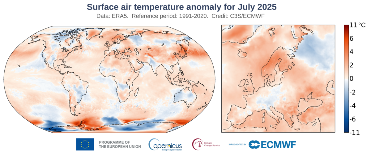
July 2025 was the 3rd warmest globally and the 7th driest in mainland Portugal, classified as very hot in terms of mean air temperature and very dry in terms of precipitation.
For air temperature, it was the 9th warmest July since 1931, with the mean air temperature +1.02 °C above the 1991–2020 average. The mean maximum air temperature was also above average (+1.44 °C). On 1, 3 and 16 July, more than 50% of IPMA stations recorded very hot days (Tmax ≥ 35 °C). On 1 July in particular, around 20% of stations registered extremely hot days (Tmax ≥ 40 °C), while 35% of stations reported tropical nights (Tmin ≥ 20 °C).
As for precipitation, it was the 7th driest July since 2000, with total rainfall of just 3.3 mm, about 33% of the 1991–2020 average.
Regarding meteorological drought, there was a significant increase which spread across two-thirds of mainland Portugal, with the northwest region particularly affected. By 31 July, about 67% of the territory was under meteorological drought.
December 2025 - monthly summary
December 2025 was the 7th wettest and 11th warmest December in mainland Portugal since 2000. It was classified as normal in terms of mean air temperature and wet in terms of precipitation.
Regarding air temperature, it was the 11th warmest December since 2000, with a mean air temperature of 9.94 °C, +0.19 °C above the 1991–2020 normal. The mean maximum temperature, 13.85 °C, was 0.06 °C below average. The mean minimum temperature, 6.04 °C, was +0.45 °C above normal. During the month, air temperature values (maximum, mean and minimum) were above the monthly average from 4 to 14 December, and below average on 21, 22, and from 24 to 27 December.
In terms of precipitation, it was the 7th wettest December since 2000. The total monthly rainfall in December, 157.8 mm, corresponds to 137% of the 1991–2020 average.
As a result, the mild meteorological drought that still existed at the end of December in the districts of Évora, Beja and Faro came to an end.
A cold spell occurred during the last ten days of the month, with air temperatures well below average, particularly minimum temperatures. On 26 December, 45% of weather stations recorded negative minimum temperatures.
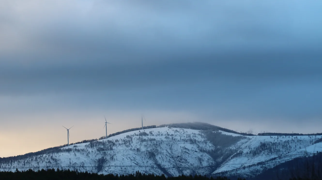
Snowfall also occurred between 21 and 24 December above ~400m, occouring in many unuaual locations in the North and Centre of Portugal.

January 2025 - monthly summary
The preliminary summary of the climatological bulletin for January 2026 for Mainland Portugal has been published. This is the preliminary version, based on the data currently available, and the final document will be published in mid-month.
January 2026 was classified as very wet and warm.
Air temperature
The month was classified as warm, with a mean air temperature of 9.19 °C, +0.15 °C above the 1991–2020 normal.
The mean maximum air temperature was 12.71 °C (an anomaly of −0.64 °C relative to normal), and the mean minimum air temperature was 5.66 °C (an anomaly of +0.93 °C relative to normal).
Precipitation
Total rainfall was well above normal, corresponding to around 222% of the 1991–2020 average. As a result, January 2026 was classified as very wet, making it the 2nd wettest January since 2000.
Other relevant highlights
Particular note should be made of Storm Kristin, which produced wind gusts exceeding 130 km/h in the districts of Coimbra, Leiria and Castelo Branco. Within the IPMA station network, the highest gust was recorded at the Leiria meteorological station, reaching 156 km/h on the 28th at 05:20 UTC.
Regarding the soil mositure, all municipalities show soil water values above field capacity, with the northern interior, the Central region and the southern coastal area very close to full soil saturation.